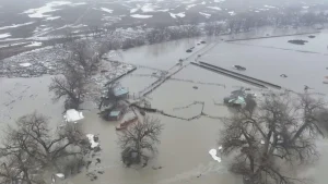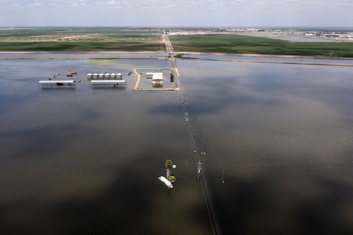


Tulare Lake once covered around 700 square miles and could grow to as much as 1,000 in extremely wet times. It began shrinking in the late 1800s as irrigated agriculture took hold in surrounding lands, and since the middle of the 20th century it has been completely dry most of the time. But not this spring. The lake has reclaimed more than 100 square miles so far, and with most of the record southern Sierra Nevada snowpack still to melt, it’s likely to keep growing.
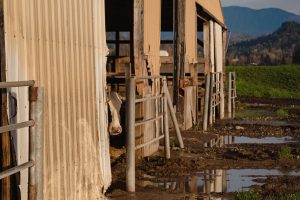
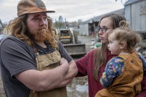
The lakebed itself is sparsely populated, although subsidence from groundwater pumping has put several communities along its eastern edge (the biggest by far is Corcoran, population 22,535) at increased risk. Frantic levee work over the past few weeks has reduced the odds of a serious residential inundation, although it’s already too late for some outlying homes and dairy farms near the lake and the rivers that feed it.
The crops grown on the lakebed are for the most part annuals such as cotton and tomatoes, not permanent vineyards or orchards. It was last inundated to anywhere near this extent in 1983, with the water staying for two years in some places. The cost in lost revenue to farmers whose lands were flooded was high, with the US Army Corps of Engineers estimating $132 million ($400 million in 2023 dollars) in agricultural damages in the four counties in the lake’s watershed. But those four counties had agricultural revenue of $25 billion to $30 billion in 2021, depending on who’s counting,(1) the vast majority from lands unlikely to be flooded.
For what’s known to water nerds as the Tulare Lake hydrologic region and to everybody else as the southern San Joaquin Valley, the chief economic significance of this year’s deluge is instead the opportunity it presents to postpone a reckoning from more than a century of pumping more water out of the ground than seeps back in and maybe even put the region’s ever-thirsty agricultural industry on a path to sustainability. I wrote about these issues during California’s last very wet spring five years ago. They haven’t gone away, but there has been fitful progress. And as the former farm editor of the Tulare Advance-Register (for about 13 months in 1988 and 1989), I certainly am not going to pass up another chance to write about the region that generates more farm revenue than any other in the US — and uses more water in doing so than all of California’s residential, commercial and industrial users combined.
As you can see from all the wetlands marked in gray on the above 1873 map, the aquatic endowments of the Tulare Lake basin went far beyond the lake proper. When painter and naturalist John Woodhouse Audubon (son of John James) arrived in what he called the Tulare Valley in November 1849 — early in California’s annual rainy season — it was already sopping wet. “During the dry season this great plain may be travelled on,” he wrote, “but now numerous ponds and lakes exist, and the ground is in places, for miles, too boggy to ride over, so we were forced to skirt the hills.” At the north end of the basin, Audubon encountered what he called “the river of the lakes,” where the Tulare basin’s excess water in extremely wet years sloshed into the San Joaquin River, by which it traveled north into the San Francisco Bay.
It wasn’t that the region got much rain. Areas that receive less than 10 inches (25 centimeters) in average annual precipitation are generally considered deserts. Fresno, near the northern edge of the Tulare Lake basin, has received an average of 11.5 inches since the late 1800s; Bakersfield to the south, 6.5. But with the highest mountain peak in the continental US and eight of the 10 highest in California along its eastern edge, the basin could count on a huge if uneven supply of melted snow, almost all of which stayed there rather than flowing out to sea.
In the decades after Audubon’s visit, farmers began to dry out the lands and channel the water, first to accommodate the cattle herds of San Francisco beef barons Miller and Lux, then the wheat fields depicted in Frank Norris’s 1901 novel The Octopus, then cotton, then on to today’s relative diversity of crops. The basin’s four counties — Fresno, Tulare, Kern and Kings — accounted for 49% of California’s agricultural revenue in 2021 and probably around 5% of the national total.(2) The most recent national agricultural census for which the US Department of Agriculture has released results is from 2017, at the tail end of a terrible drought in California, and the Tulare basin counties together with the four counties of the northern San Joaquin Valley still occupied six of the seven top spots in the US county rankings and eight of the top 18.
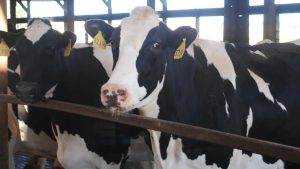
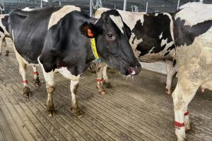
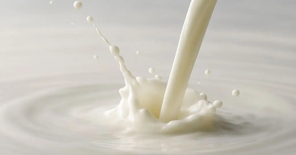
In 2021, the region’s top farm products were grapes and milk, with almonds and pistachios the big gainers in recent decades.
Water diverted from the region’s four main rivers (from north to south, Kings, Kaweah, Tule and Kern) provides some of the supply needed to grow all of this, but in all but the wettest years groundwater is the chief resource. In the early days, the water table was so high that all one had to do was dig and water came spurting out of the ground. By the 1890s, farmers in the region were beginning to use gas and steam pumps, and in 1900 the first electric pump was installed. By mid-century, Tulare Lake was just about gone, the water table was falling fast and area farmers needed a water bailout, which they got in the 1950s from the federal Central Valley Project and in the 1960s from California’s State Water Project, both of which took water from wetter regions to the north and delivered it to the Tulare Lake basin.
Over the past two decades, Tulare Lake basin farmers have used an average of 10.8 million acre-feet of water a year to grow all those crops. An acre-foot is 325,851 gallons, or 1.2 million liters, but a more meaningful comparison is to the total applied water use by agricultural and urban (residential, commercial and industrial) users in California, which averaged 42.2 million acre-feet over the same period. That’s right: Agricultural users in the Tulare Lake basin accounted for almost a quarter of all California water use by humans — and 27% more than all the state’s urban users combined.
Perhaps more important, 10.8 million acre-feet acre feet of water is more than Tulare Lake basin farmers can now count on from the region’s rivers, a sustainable pace of groundwater extraction and imports from points north — which have been crimped over the decades by drought, increased demand from Southern California cities and environmental regulations. The Public Policy Institute of California has estimated that groundwater overdraft in the San Joaquin Valley averages 2 million acre-feet a year. The Tulare basin accounts for about two-thirds of that, with predictable effects such as rapid land subsidence in parts of the region and many wells going dry.
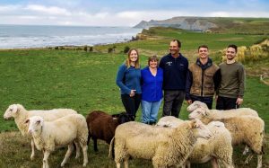
In 2014, the state legislature passed a package of bills, together known as the Sustainable Groundwater Management Act, meant to eventually end this overpumping. Areas with overdraft issues were required to create Groundwater Sustainability Agencies charged with crafting plans to bring long-term groundwater use and supply in balance by 2042. It’s an excruciatingly slow, conflict-filled process, but talking about it last week with longtime observer Ellen Hanak, director of the PPIC Water Policy Center, I was struck by how optimistic she sounded. “There’s progress,” she said. “It’s just that it’s hard and sometimes it’s two steps forward, one step back, sometimes one step forward, two steps back.”
OK, maybe she’s not that optimistic. But in the Tulare Lake basin, farmers did cut back water use during recent droughts, mainly by fallowing less productive land, and they’re making headway this year in replenishing groundwater supplies. West of Bakersfield, parts of the porous Kern River “alluvial fan” have been used for groundwater recharge for decades. Right now, pretty much the entire thing is under water.
Smaller such efforts are under way around the Tulare Lake basin, encouraged by a March 10 executive order from Governor Gavin Newsom that suspended most permitting requirements for floodwater diversions intended to recharge groundwater. The reappearance of Tulare Lake itself isn’t much help on this front; it was/is a lake in part because the ground under it isn’t porous. But the combination of an extremely wet winter and spring, and the prospect of rules barring farmers from pumping more water out of the ground than is replenished naturally and through human efforts, is bringing a lot of groundwater-recharge experimentation that as a side benefit should slow the growth of Tulare Lake. Which sounds like, well, progress.