A new project offers help as picturesque Taranaki region’s water challenges come to a head on scores of farms.
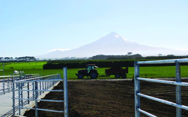
Cows grazing on lush pastures under azure skies, with snow-capped Mount Taranaki in the distance – it’s an iconic image of rural New Zealand.
But the idyllic landscape presents some real challenges for those dairy farming on the volcanic mountain’s slopes.
Taranaki sees high rainfall, often in sharp bursts – and the higher the altitude on the mountain, the more rain. Severe rain events of 50mm an hour and 200mm in 24 hours are not uncommon, with these events increasing in the past few decades and likely to continue to increase as the climate warms.
This high rainfall, plus the slope, make effluent management challenging at times, said Lauren McEldowney, farm systems consultant with AgFirst Taranaki.
In the past, Taranaki Regional Council permitted some farms to discharge effluent to water after pond treatment, while other farms have dual consenting for discharge to land and discharge to water, McEldowney said.
But the council is moving away from discharge to water consenting, with Fonterra also calling for a halt to the practice from June 1 2025.
Over 100 farms on the mountain slopes may soon be non-compliant.
As part of a team from AgFirst, with funding through the Rural Professionals Fund from Our Land and Water, McEldowney looked at gathering more localised weather, contour and soil infiltration rates than currently available through regional rainfall averaging and large-scale blanket soil mapping.
Weather stations will be installed on four case-study farms on the north, south, east and westerly slopes of Mt Taranaki, along with two soil moisture sites on each farm with sensors set at 100mm and 300mm depths.
Likely impacts of nutrient management, capital expenditure and impacts on farm systems will also be looked at.
The project aims to build a new database for farmers to compare their farm’s conditions – including elevation and position on the mountain – to define their physical and soil characteristics more accurately, to understand how they are affected by rainfall.
This should give a more accurate idea of the numbers of days effluent irrigation can be used. From there, current effluent management systems setups can be altered to be fit for purpose. This may include using pond covers, bladder type systems, stormwater diversion, or catching rainwater in tanks. New, tailored effluent management systems may also be needed for some.
The project will run until mid-2024, with the team hopeful the methodology and results will also be of use in other regions with high rainfall.
High rainfall and sloping land means Taranaki soils have been classified as high risk for effluent discharge to land.
High rainfall sees hundreds of watercourses running down through farmland around the mountain, with effluent irrigators needing to keep minimum distances from these. Large volumes of rainwater risk entering effluent storage ponds.
Various eruptions over millennia have deposited volcanic ash and debris on different sides of the mountain, which now means different soil types fan out and around the mountain. Rocky mounds from lahars can run through otherwise flat paddocks, also making the use of effluent irrigators difficult in some places.
